

Forest Fire in Hatay: The Face of a Disaster Seen From Space
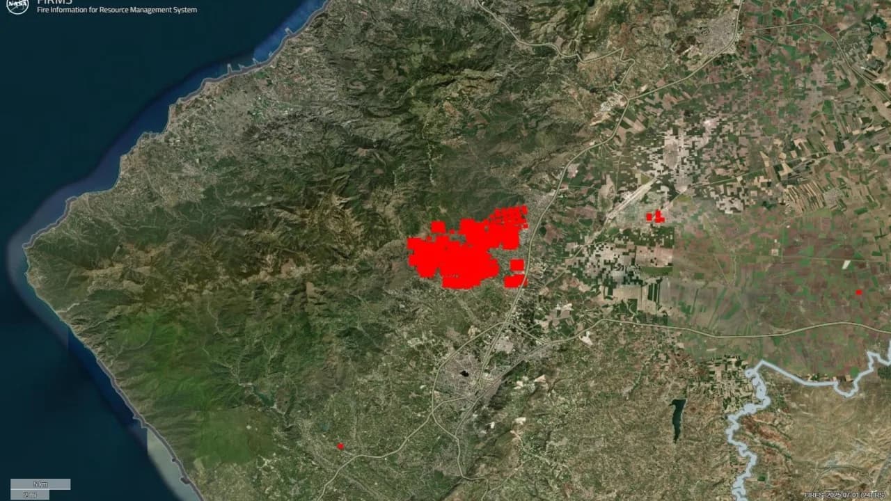
Hatay is experiencing one of the largest environmental disasters in its history, caused by a forest fire that began on 29 June 2025.
1. Introduction: It Is Not Only the Forest That Is Burning
Hatay experienced a forest fire that began on 29 June 2025 and affected a wide area. Looking at the satellite imagery, we can see that the fire threatens not only forested areas but also agricultural land, the surroundings of settlements and the ecological balance. This fire shows us that the global climate crisis is no longer an abstract concept, and how concrete it has become in the geography we live in.
2. The Development of the Fire: What Do the Satellite Images Say?

Contains modified Copernicus Sentinel data (2025)
- For example: "The increase in smoke density between 29 June and 1 July is clearly observed in the Sentinel-2 image. This reveals how quickly the fire spread with the wind."
3. Why Is It Spreading So Fast?
The Hatay region has a typical Mediterranean climate: hot and dry summers. However, during this summer period, temperatures running above normal and low humidity caused the forests to catch fire easily. Combined with the effect of the wind, the fire became uncontrollable within a short time.
- In June 2025, temperatures above the seasonal norms were observed in the region.
- Forest fires tend to spread faster during the midday and afternoon hours, when wind speeds increase.
4. Global Warming and Hatay: Is This the First Time?
Hatay has been the scene of similar fires many times over the last 10 years. This fire, too, spread rapidly over a wide area. As the global temperature rise approaches the 1.5°C limit, the forest cover in the region has become more fragile. This increases both the likelihood of ignition and the speed of spread.
5. Effects on the Ecosystem and Agriculture
- Beekeeping activities are at risk. Fires spreading into olive groves can lead to long-term economic losses.
- The destruction of forested areas along bird migration routes will directly affect biological diversity.
- After the fire, the soil will become prone to erosion, and agricultural productivity will decline.
6. Conclusion
In my earlier article on the California fires, I explained that with climate change we can no longer predict the direction and speed of winds, that we will see this kind of fire more often as temperatures rise, and what measures we could take. I will not go into our technical shortcomings and strengths, as I am not an expert on that, but rainfall is low and dam occupancy rates are running low. Fire is now our reality, and we need to take our measures at a global level.
Zafer Doğan · Urban Planner
This article was first published on LinkedIn: Zafer Doğan — Forest Fire in Hatay: The Face of a Disaster Seen From Space
This article has been prepared for general information purposes only and does not constitute legal, financial, technical or other professional advice. Legislative and technical information reflects the position as at the date of publication. Short extracts may be quoted provided that the source is cited and a link to the article is given; publication of the article in full or of a substantial part of it is subject to written permission. Terms of use